

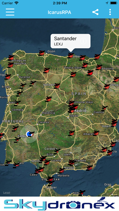
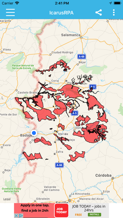

Interactive map where all the airspace with restrictions to fly RPAs (UAV) in Spain and Portugal can be checked.
IcarusRPA is a map based tool that shows graphicly the flying restrictions involving RPAs in Spain and Portugal. All performance data have been adapted from the AIP (Aerocraft Information Pbls), which is the basic manual of aerocraft information basic for flying and operating the RPAs (UAV).
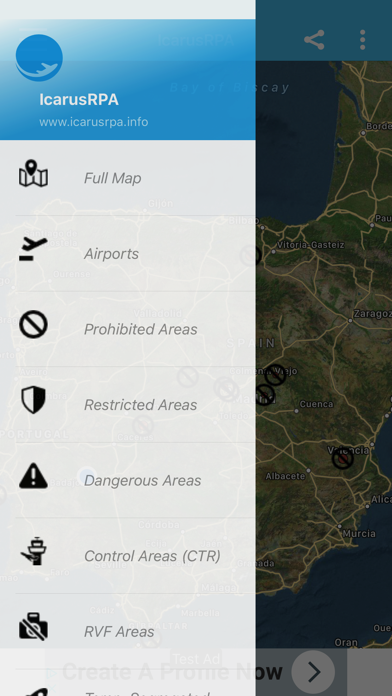
Important information affecting air operations (as Metar or Tafor of any airport -ICAO format-) can be consulted, including the Notam of airports and FIRs. The tool host different meteorological maps showing real time data of wind speed, clouds, rain and the planetary K-index (Kp), used to measure the magnitude of geomagnetic storms.
The following information is shown:
- Restricted Areas
- Restricted Temporary Areas
- Prohibited Areas
- Dangerous Areas
- Control Areas (CTR)
- Fotographic Flying Restricted Areas (ZRVF)
- Temporary Segregated Areas (TSA)
- Other Protected Areas
- Aerospaces
- No Fly DJI (NFZ)
GIS Viewer
The application is totally free. However, you have the option to activate an automatically renewable annual subscription, which will remove all ads from the application, for 1 year. This subscription has an associated cost, which will be charged to your iTunes Account, when you confirm the purchase. The subscription is automatically renewable, unless canceled, at least 24 hours before the end of the subscription. If it is not canceled, the same amount will be charged from your iTunes account, in the 24 hours prior to the end of the subscription. You can activate this subscription in the application by accessing the main menu and clicking on the "Remove ads" option. You can cancel this subscription by accessing Account Settings.
Privacy Policy and Terms & Conditions: http://www.icarusrpa.info/politica-privacidad.php